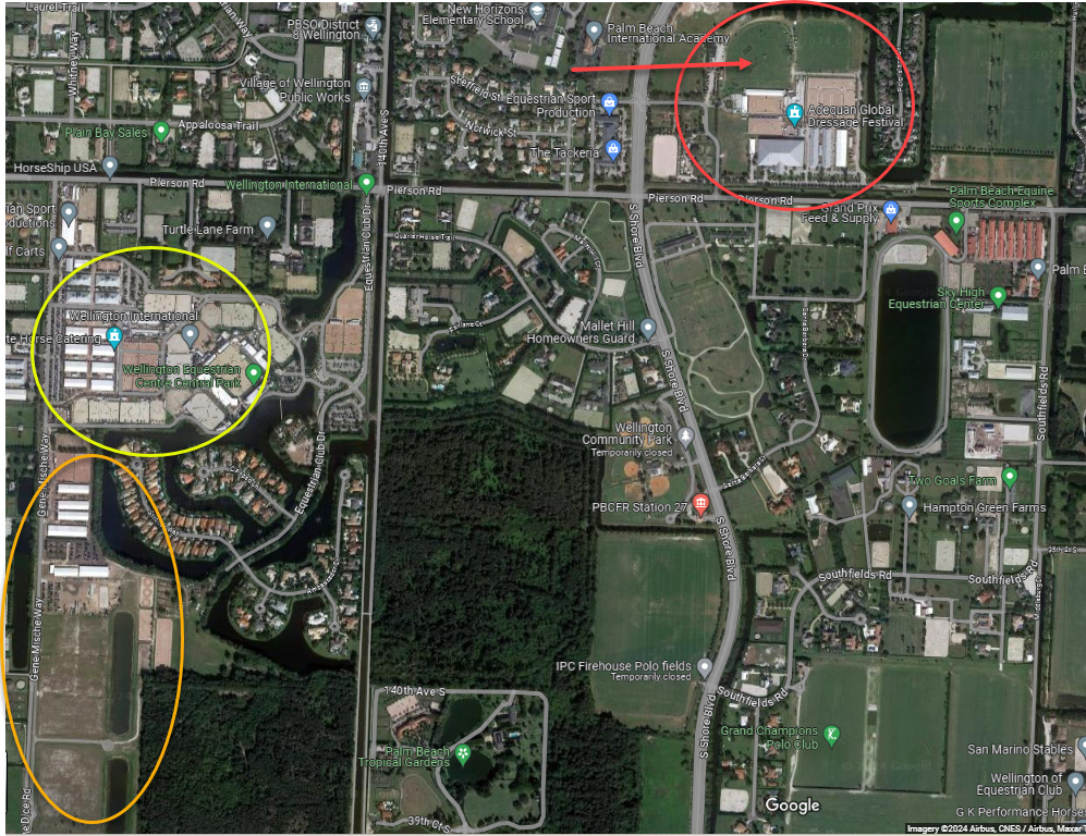
I captured this out of Global Maps and added some callouts to the images. Can someone let me know if I understand this correctly?
- The red circle is the current location of Global Dressage Festival (GDF)
- The red arrow is the derby jumping field used for H/J competitions
- The yellow circle is Wellington Equestrian Festival (WEF) - used pretty much exclusively for H/J
- The orange circle is the Wellington South Parcel
What is under consideration by the town council is for the GDF parcel (and the derby jumping field) to be removed from the umbrella “Equestrian Preserve” so the existing facilities can be demolished and the land repurposed for residential and commercial development.
If that happens, then is that the end of big international dressage competitions in Wellington, or do the current owners of GDF intend for dressage to move to the WEF location? If so, is that big enough for them to share? Didn’t I see somewhere that WEF is already overcrowded, esp. in regards to spectator parking?
And is the south parcel (orange circle) where TPTB envisions WEF expanding so there is room for both dressage and H/J at the WEF location?